written by Allison Miles | photo by Kevin Grove
For backcountry skiers and ski mountaineers with a hunger for adventure, Oregon is the $5.99 all-you-can-eat buffet, minus the heartburn. From steep, narrow couloirs and 5,000-foot lines to wide-open bowls and old-growth forests dappled with glades, the variety is as bottomless as the powder. Whether you have a week to spare or just one day, it’s not difficult to trade out bustling civilization, noisy lift lines, the boom of avalanche control, and crowded groomers for the quiet peace of a snowy mountain wilderness and any line you choose. If you need a little push, here’s some inspiration for outstanding skiing in all four corners of Oregon.
Mt. Hood
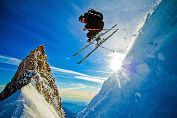
photo by Richard Hallman
Proximity to a population-dense region, an international airport, and a network of major highways makes Oregon’s tallest mountain the most accessible terrain, yet Mt. Hood’s ruggedness, fickle weather and sheer size demand respect from even the most seasoned mountaineers. Perhaps it’s these paradoxes—approachability and risk, proximity and remoteness—that stir forth the adventurous spirit and make Mt. Hood one of the most frequently climbed glaciated peaks in the world.
Mt. Hood’s classic ski descents include the Old Chute, Wy’East and Leuthold’s Couloir. Old Chute doubles as the popular mountaineering route on the south face, with a steep forty-five-plus-degree slope off the summit ridge that eases below Crater Rock. The Wy’East face sits above the Mt. Hood Meadows Ski Resort. This southeast-facing route drops in at forty-plus degrees before mellowing farther down the face. The Leuthold Couloir meanders up Mt. Hood’s west face between Yocum Ridge and the Reid Headwall. From the summit ridge, descend about 1,600 feet at forty-five degrees through the couloir to the Reid Glacier before climbing over Illumination Saddle and then dropping to Timberline Lodge.
Mt. McLoughlin
The relatively secret gem of Southern Oregon is Mt. McLoughlin, the tallest peak in the Oregon Cascades south of the Three Sisters. With a variety of slope angles and geographic features, Mt. McLoughlin is an uncrowded and aesthetic backcountry playground for any level of skier. On a clear day, the narrow summit crest promises views of the Klamath lakes, Mount Shasta, Crater Lake’s rim and Mt. Thielsen, as well as dreamy 3,000-foot ski lines.
One of Oregon’s lesser known and relatively overlooked volcanoes, Mt. McLoughlin sits west of Upper Klamath Lake, along the Cascade Volcanic Arc between Crater Lake and Mount Shasta. The 9,495-foot-tall stratovolcano features a nearly-symmetrical conical shape that is best skied from late winter through spring. Classic descents include the northeast and north-facing bowls, which offer up to forty-five-degree drop-ins that skiers then skirt beneath towering rock walls before mellowing out and coasting to the tree line.
The standard approach to Mt. McLoughlin’s summit is via Trail 3716 along the volcano’s eastern ridge, which can be reached from the Pacific Crest Trail off Highway 140 or a well-marked trailhead off Forest Road 3650, depending on the snow level and time of year.
The Wallowas
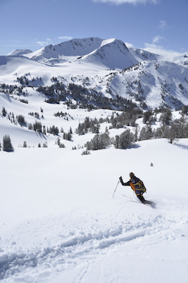
photo by Leon Werdinger
The Wallowas, known as the “Alps of Oregon,” constitute a forty-mile mountain range nestled between the Blue Mountains and the Snake River in northeastern Oregon. More closely resembling their Rocky Mountain neighbors to the east than the Cascade volcanoes to the west, the Wallowas are made up of glacially-carved granite peaks and broad valleys dotted with alpine lakes. At least thirty-one of the peaks top 9,000 feet, the tallest of which is Sacajawea Peak at 9,838 feet, closely followed by its neighbor to the south, Matterhorn, at 9,826 feet. The area makes up the Eagle Cap Wilderness, the largest wilderness area in Oregon.
With so much wilderness and terrain to explore and the remote location, the Wallowas are best as a multi-day trip. One option is to book a four- or fiveday trip with Wallowa Alpine Huts, which includes a variety of skiing terrain and cozy nights spent in yurts. For quicker trips, select an objective or two and shorten the approach by taking a snowmobile to the wilderness boundary. Those who are either on a budget or prefer unsupported, human-powered expeditions can still access plenty of terrain right out of Joseph. From Salt Creek Summit Sno Park, head four miles to Wing Ridge or six miles to Aneroid Mountain and find plenty of lines within a day trip.
Steens Mountain
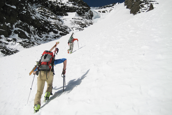
photo by Kevin Grove
Steens Mountain, often mistaken for a mountain range, is actually a single faultblock mountain located in the remote southeastern corner of Oregon. Steens stretches about fifty miles in length from north to south and rises to 9,733 feet in elevation. The mountain’s rugged east-facing rim is primarily formed from stacked basalt and fourteen-million-year-old lava flows that overlook the Alvord Desert’s vast playa 4,500 feet below. The dramatic landscape is aptly matched by the region’s severe climate, known for extreme hot and cold temperatures, as well as sudden violent storms.
When it comes to skiing the Steens, remoteness and extreme weather can be mitigated by proper planning. The expanse of land—shaped by both tectonics and glaciers over the epochs—offers a plenitude of terrain that tests the imagination of any adventurous backcountry skier. Note that getting to the ski terrain during winter and spring can be tricky due to road closures and a mix of private ranches and public land surrounding Steens. Plan ahead and call the Burns District BLM Office for information on how to access the terrain.
Gear: Base layers and shell outerwear, climbing skins, avalanche transceiver, avalanche probe, shovel, repair and medical kits, headlamp.
Safety: Educate before you recreate. Mountain Savvy avalanche courses in Mt. Hood, mountainsavvy.com. Wallowa Avalanche Center in Joseph, wallowaavalanchecenter.org. Three Sisters Backcountry avalanche courses in Sisters, threesistersbackcountry.com
Resources: For more information on backcountry skiing go to oregonskiguides.com or skiingthebackcountry.com.


