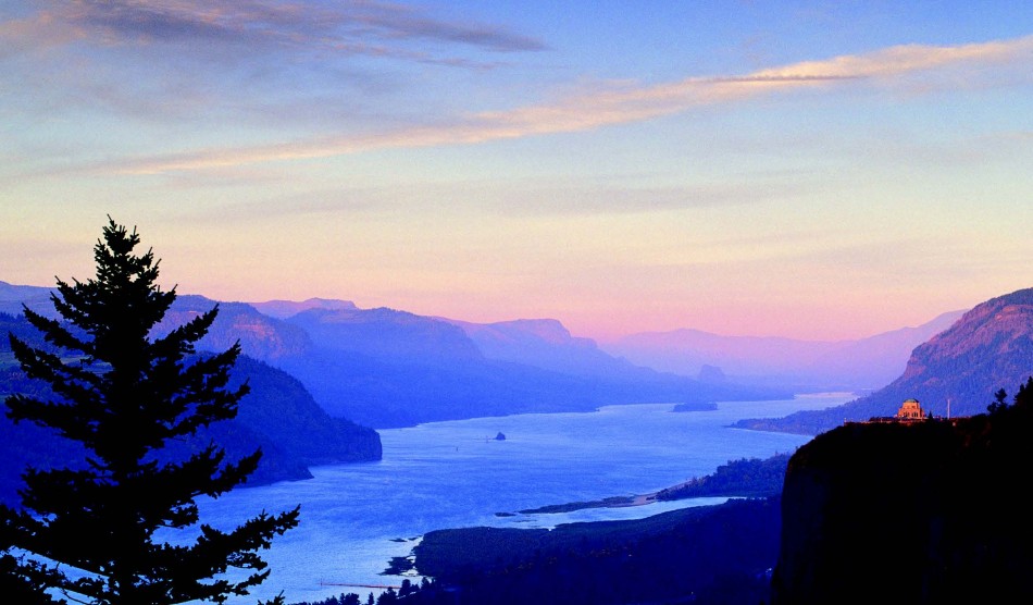
Had Woody Guthrie composed his 1940s river anthem today, “Roll On Columbia, Roll On” would perhaps be more aptly titled “Roll Along Columbia.” Today thousands of motorists now travel a major interstate freeway which follows the mighty river and meanders a historic highway. On their way, visitors can view majestic sights courtesy of Columbia basalt flows and the massive Missoula Floods that carved the Columbia River Gorge ages ago, plus learn the history of the people who settled the region. One of the highways, I-84, emphasizes speed and commerce along the Columbia Gorge. The other, the Historic Columbia River Highway, slows you down and brings you close to the picturesque beauty of the Columbia River Gorge National Scenic Area.
At milepost 31 on I-84, Multnomah Falls is the first major natural attraction in the Gorge. Visitors have easy access from both directions. At 620 feet tall, the falls are the second highest of all waterfalls in the United States. These falls shower visitors with a steady stream of glacier water that originates under Larch Mountain and meanders through the Mt. Hood National Forest to its cascade adjacent to the historic highway. The Falls Visitor Center and Multnomah Falls Lodge with its full-service restaurant are within easy walking distance under the tunnel from the parking lot in the middle of I-84.
Visible in the rock face of the falls are five layers of Columbia basalt exposed by erosion. When stream flows are lower, the hidden “Indian Maiden” face appears about half way down the cliff.
Motorists who want an up close and personal experience with the western Columbia River Gorge National Scenic Area can enter the Historic Columbia River Highway at milepost 35, the same exit for Ainsworth Park. Ainsworth is one of eighteen state parks from the Sandy River to The Dalles.
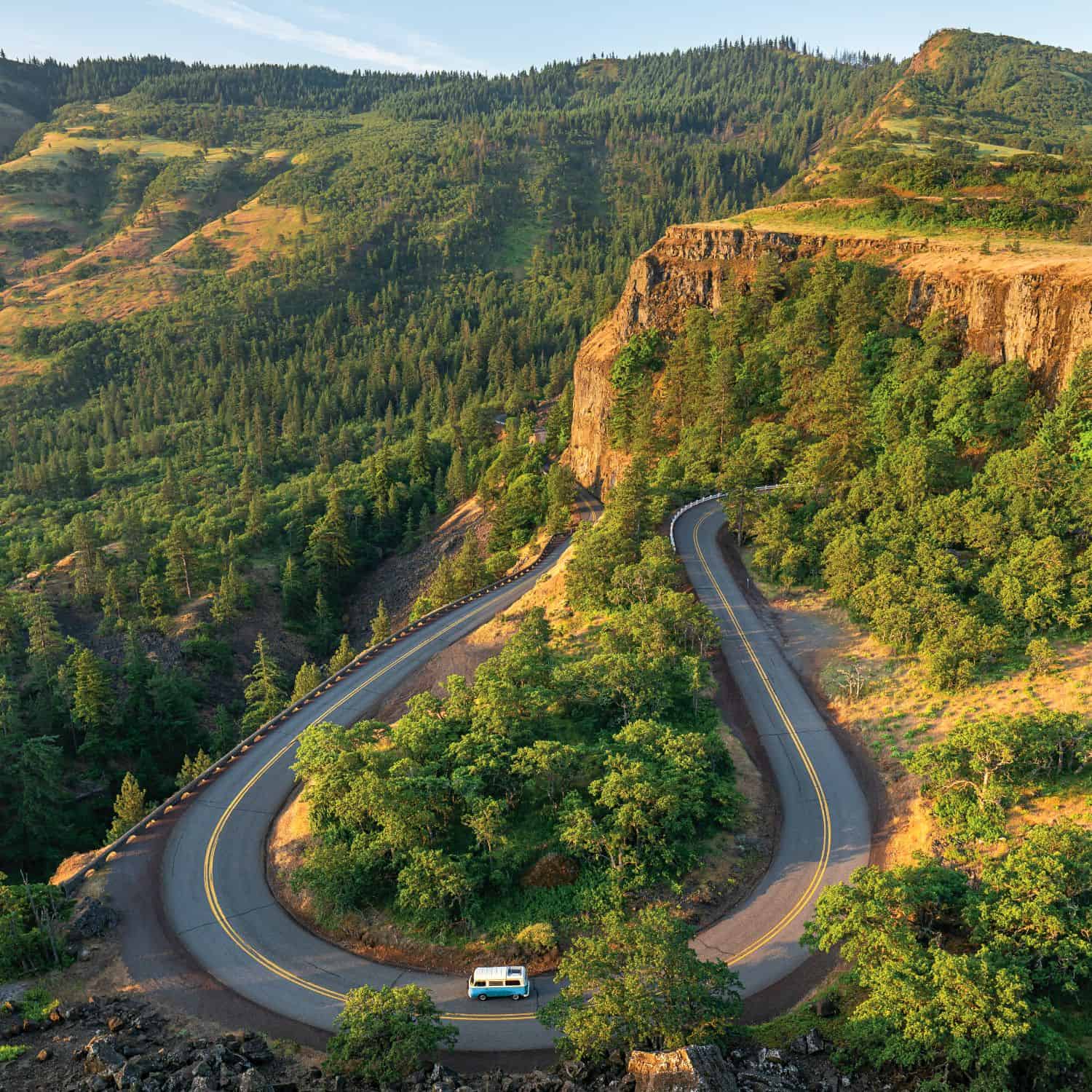
When the original highway was built in 1913, designers cared little for expense and speed instead plotting the road to reach every beautiful feature within reason. The prevailing idea was to make this highway a great scenic boulevard surpassing all other highways of the world. The “King of Roads” as it was called, the Columbia River Highway was the first planned scenic roadway in the United States.
Thanks to engineer and landscape architect Samuel C. Lancaster, roads promoter Samuel Hill and Friends of the Historic Columbia River Highway, we can roll along that beauty today.
Congress authorized construction of I-84 as part of the Federal Highway Act of 1956. That year, the Oregon Highway Department (precursor to Oregon Department of Transportation) started building thirty miles of the I-80N (I-84) freeway to the east of Portland.
Guthrie wrote his tune, “Roll On Columbia, Roll On” in 1941 when he was hired by the Bonneville Power Administration to promote federal hydro power projects on the Columbia, especially the Bonneville Dam at milepost 40. President Franklin Roosevelt kicked off construction of the dam in 1934, and the first consumer-use electricity came on line in 1938.
Today travelers can see the spillway, two powerhouses, the fish hatchery and spend time at the dam’s visitor center. Besides watching migrating fish moving through underwater corridors, visitors will find a five-level facility with an observation deck, exhibits, restrooms, a large theater, and allglass exterior walls for panoramic views of the Columbia River Gorge. Bonneville Dam is open year round, but the best time to spy running salmon is April to September, when the fish are most abundant.
At Cascade Locks, milepost 44, the Bridge of the Gods connects to a portion of the old US 30 and onto I-84. Its namesake was a massive landslide that dammed the river just upstream. Native Americans created a legend about the landslide and described it as a “Bridge of the Gods.” Eventually, the mighty Columbia burst through the slide, which we keep alive today in local lore with the name of the bridge that connects Oregon and Washington.
Just west of Hood River, at milepost 62, stands the majestic Columbia Gorge Hotel. Originally built in 1904 as the Wah Gwin Gwin Hotel (a Native American term for “rushing water” for the 208- foot waterfall on the grounds), lumber baron Simon Benson bought it in 1920 to make it his premier destination at the eastern end of the early twentieth century highway. Presidents, stars and other visiting dignitaries helped the hotel earn an international reputation. The historic hotel, with stunning views of the river, are now open to the public.
It was to the east of Hood River, at about milepost 76, where the greatest of the Missoula Floods crashed into a rock dam and surged over Rowena Crest about 1,000 feet above the floor of the riverbed. Today the perch offers spectacular views of the eastern gorge and the serpentine Historic Columbia River Highway that climbs its shoulders.
From this vantage point, visitors can see some of the islands that, in the past, served as burial grounds for Native Americans. Memaloose Island is one of them. The numerous islands nearby that served the ancients as burial sites were named “Memaloose Ilahee” by the Chinook tribes that populated the area. Ironically only one monument tops the island today. That is the grave marker for Victor Trevitt, a local dignitary who was buried there in 1883.
Milepost 82 marks the unofficial eastern terminus of the old Highway and the Gorge, too. It’s also the western city limits of The Dalles, home to the Columbia Gorge Discovery Center and the Wasco County Museum. Here visitors can take a few minutes or hours to see and learn about the geology and history of the corridor. The land created by eons of rock layering and chiseled by water has been inhabited for as many as 31,000 years. Generations of Chinook and their descendants and associated tribes continue to inhabit its nearby shores and communities in the Columbia River Gorge.


